The Importance of Habitat Mapping
Understanding where key habitats are found is vital. It allows us to plan effective nature recovery projects, to link existing patches of good quality habitat together and to create a nature recovery network.
Habitat creation and restoration which is targeted in this way makes ecosystems more resilient and contributes to our target of 30% of land and sea connected, protected and managed for nature's recovery by 2030.
What is the habitat mapping project?
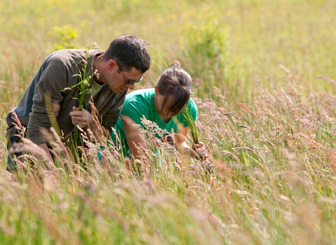
In 2021, the trust began a citizen science project, to provide volunteers with the skills and resources to map habitats of principal importance (HoPIs) in the Shropshire countryside.
The project aims to:
- Improve people’s engagement with nature, by providing citizen scientists with the necessary skills to recognise and record habitat type and condition.
- Build a map which would support local engagement in nature recovery.
- Ground-truth and augment existing habitat maps so that we develop a better understanding of habitats in Shropshire.
Habitats of principal importance (HoPIs) are high biodiversity value habitats and receive consideration and protection in nature recovery policy and strategy documents at local and national levels.
How does the project work?
Surveying in the field is conducted each year during the spring and summer when plants and trees are in leaf and flower. Habitats are recorded in the field, typically by volunteer groups organised within a branch area, and are then collated by the GIS volunteer team for digitisation.
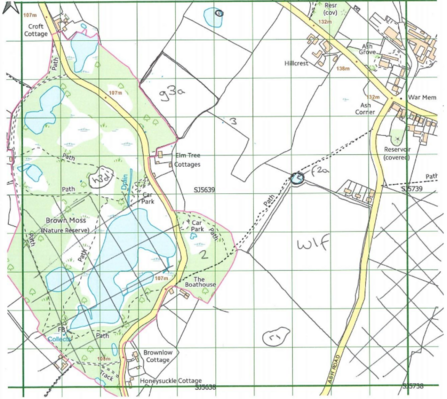
Volunteers on the project have access to an online hub containing training and mapping resources. Each year a training session, led by a professional ecologist, is organised so that beginners and experienced surveyors alike can refresh and learn new skills in habitat surveying.
During the winter the field survey side of the project dies down. Paper maps are digitised and analysed and progress is presented to volunteers at the annual review event.
What has been achieved so far?
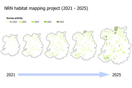
Between 2021 and 2025 over 280 km2 of Shropshire countryside has been surveyed by the project.
Combined with previous trust-associated mapping programmes, over a sixth of the county has now been surveyed by volunteer citizen scientists.
The NRN project has:
- Fed into the development of the Shropshire Local Nature Recovery Strategy (LNRS). Data from the project has supported the development of the mapping and will be key to further ground-truthing the strategy when it is reviewed.
- Helped identify important habitats that have not been mapped in other datasets. By walking the ground, NRN habitat mapping volunteers can identify small pockets of habitats which may act as ‘stepping stones’ in the development of a local nature recovery network.
- Successfully supported a recent connectivity modelling project, with the trust working in cooperation with Harper Adams University, to identify opportunities for wetland restoration in the peatlands in north-east Shropshire.
- Fed into other nature-based activities. Volunteer groups have developed the mapping resources further to plan well-informed and localised nature recovery strategies at the parish level and use the mapping to effectively engage landowners.
- Facilitated an associated hedgerow condition mapping programme to support funded restoration works in the Clee valley.
Getting involved!
New volunteers to the project are always welcome. Habitat mapping is not just a chance to develop new skills but is also a great way to get out, socialise, and experience the beautiful Shropshire countryside.
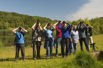
Surveys often take place off the beaten track, and many of our current volunteers enjoy the experience of finding good habitats in less travelled areas. Training sessions are held in the field and provide an informative and fun guide to habitat surveying. We can also organise group survey sessions to provide a gentle introduction to the wonderful world of habitat surveying.
Watch the video below to hear about the experiences of Habitat Mapping Volunteers and click here for the full playlist showing you how to identify a variety of Shropshire's habitats.
Volunteer applications to the project are currently open – please see our Volunteer with Us webpage for further details on how to apply. If you would like to find out more or have any queries regarding the project then please contact Fraser Baker, Evidence and Data Specialist Officer (fraserb@shropshirewildlifetrust.org.uk ).
Since starting SWT’s Habitat Mapping project, I feel I know my local landscape in a new way, at a new level. And the idea that we can then start to pinpoint where Nature Recovery could begin, really inspires me.NRN Habitat Mapping Volunteer and Volunteer Liaison
